Strip Maps – History and Science
Often on long overland journeys or expeditions, I draw a map of the route we are taking, running the map along the bottom of my pages or up the side (see right), adding little sketches of species or interesting landforms. The map is continuous from page to page. Until I started researching maps for a chapter on cartography in my forthcoming book, Master of Field Arts, I didn’t know that linear or “strip maps” were a thing.
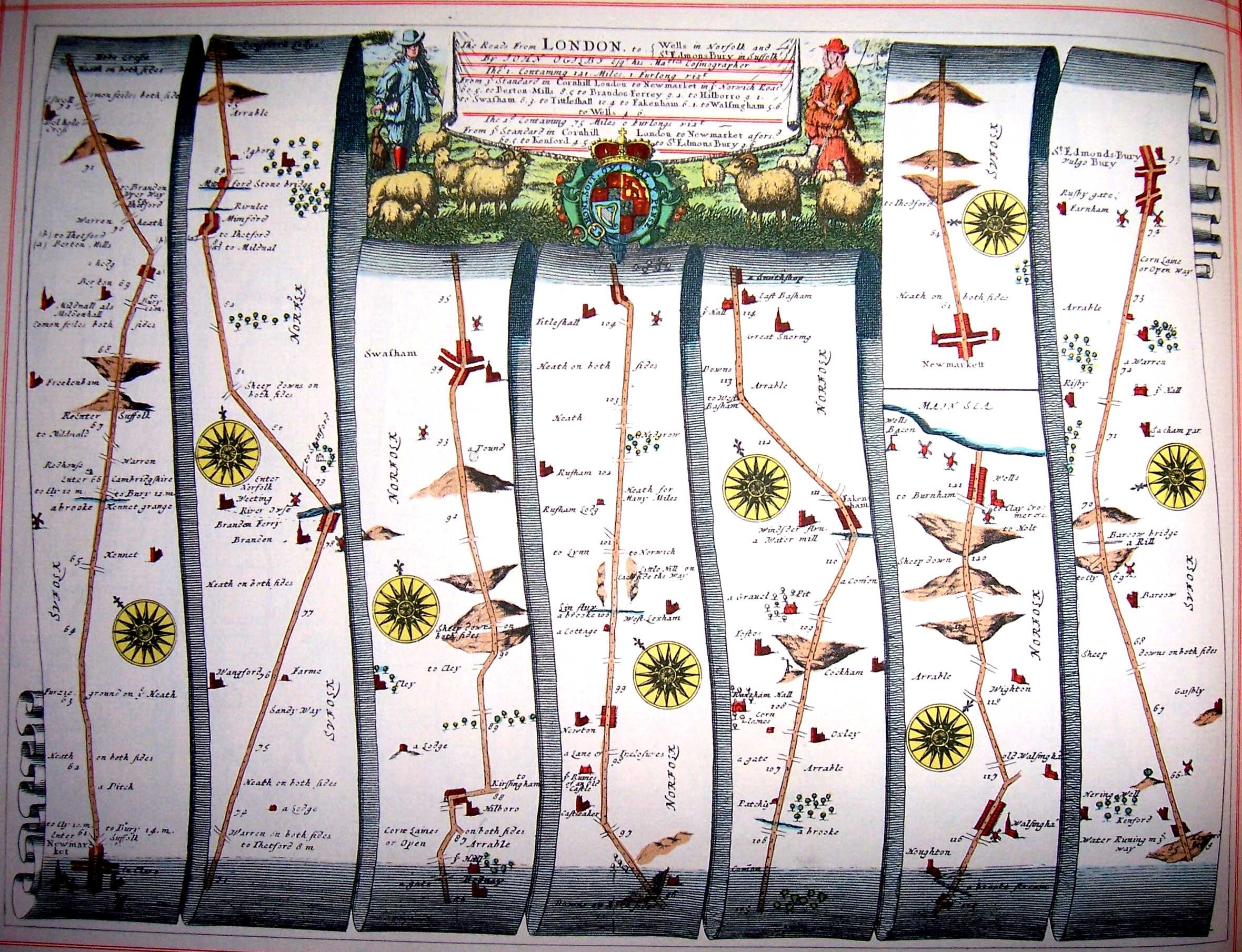
Strip maps are linear route-maps that one follows along a strip, with key landmarks, features, and times it takes to travel between points. One of the earliest was by Matthew Paris, a London-to-Apulia strip map from the 13th century (and more likely an allegory than something you would use to travel), but the one shown at top is a massive work by John Ogilby, his 1675 Britannia Atlas. The traveler starts in the lower left, travels up, the come down the next strip, then up the next, down the next.
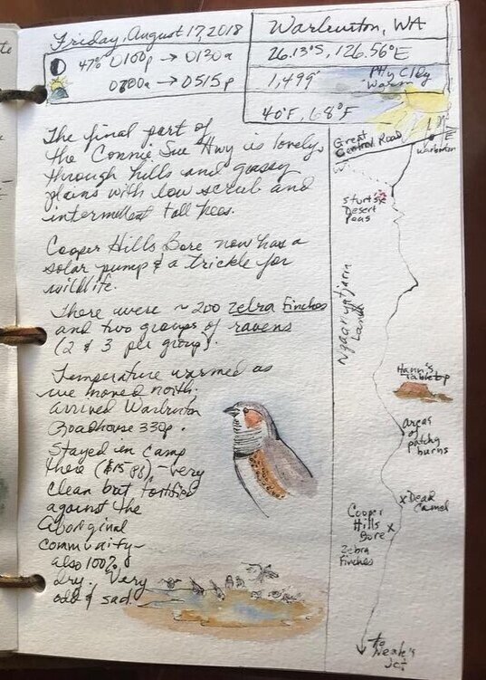
One day’s journey in 2018 as we explored the Victoria Desert in central Australia.

Ribbon Map of the Father of Waters, by Coloney & Fairchild (St. Louis, 1866). Wrapped on a wooden scroll and lined with linen, it shows all 2,600 miles of the Mississippi River. Courtesy of the American Antiquarian Society, Worcester, Massachusetts. From http://commonplace.online/article/one-mississippi/
Artist Carol Morris recently shared a 1984 paper by John Emlen, professor of zoology at University of Wisconson Madison, who employed strip maps and a mathematical model for censusing songbirds. Very simple and yet the clever thing here is a formula for calculating territories for breeding birds—this would be a great project for our nature journals.
"The method provides a continuous record, divisible into segments of any desired length, of the density, song activity, and distribution of individuals of each species through its breeding season. The detection-threshold distance and song-frequency values obtained can be used as species-specific conversion factors for translating simple detection counts to bird densities." Click on the image to enlarge.
Link to PDF of article from the Auk: https://sora.unm.edu/.../jour.../auk/v101n04/p0730-p0740.pdf

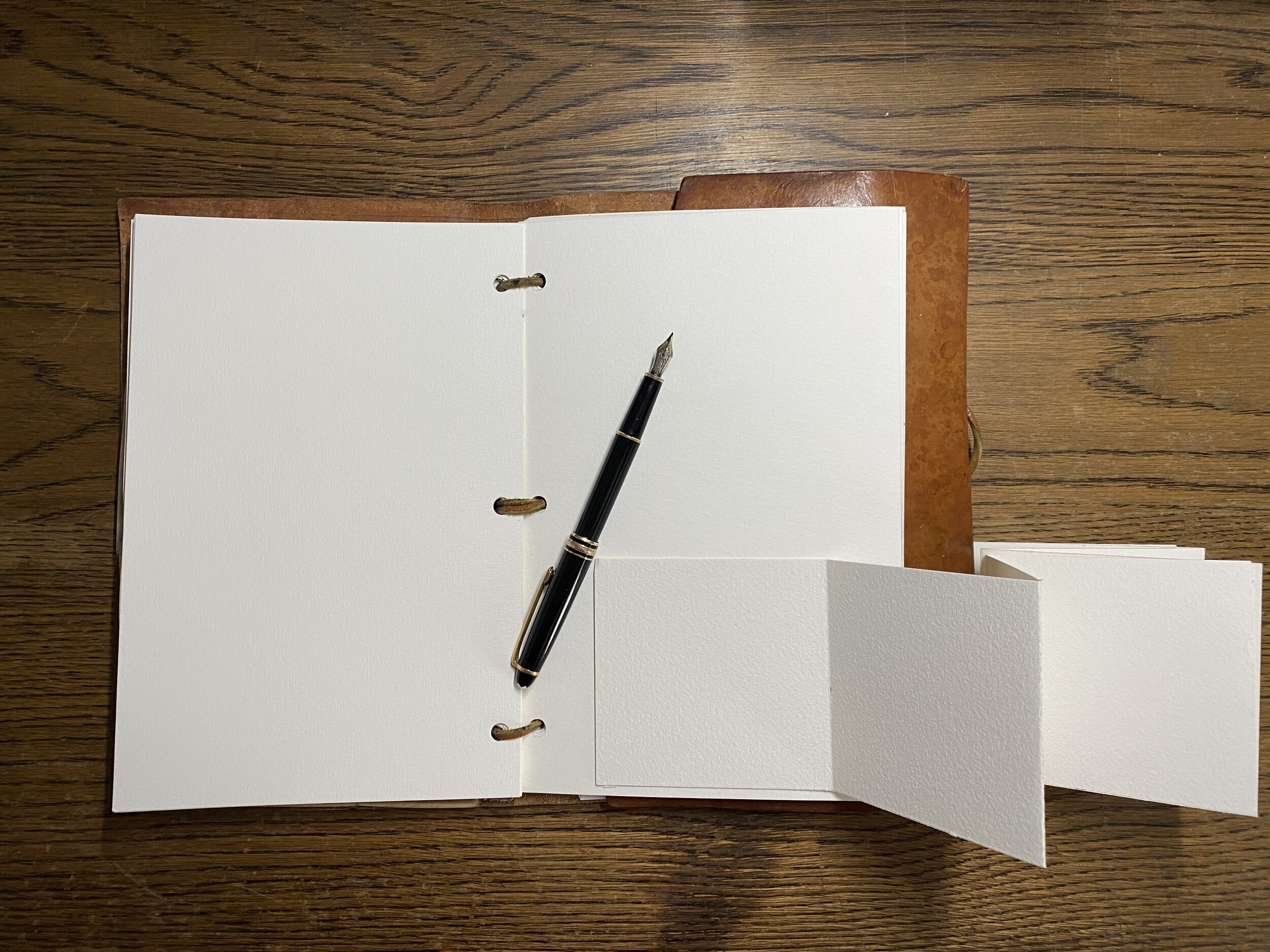
Here is another way I am now using strip maps—I cut long pieces of watercolor paper and fold them accordion-style. The map can be just one side or continue on the back side; it can run top to bottom or turn the strip on its side and run it from left to right. Glue or tape the map onto your page, or glue an envelope in which to tuck the map.

If you missed my free workshop on cartography, you can find it on my tutorials page, >HERE<.